


Military history forums and some websites repeatedly point to various measuring devices in the Arensch district of Cuxhaven. However, there is no reference to reliable sources or corresponding documents that would confirm the systems described. These devices are said to have been located in the coastal area west of the Wernerwald. Today, apart from a few communication trenches, almost nothing of them can be seen anymore. Some of the dilapidated concrete foundations and the remains of bunkers have been covered with earth and are no longer visible. According to a contemporary witness, Gerd Wildfang reports in his book (Fortresses in the City of Cuxhaven) about a Freya-LZ (air transportable) from the Lorenz company, also known as the FUMO 401. The German Atlantic Wall Archive also reports on a 1 x FMG 38 G (fB) (DeTe I, A1 device) from the GEMA company. This is a so-called sea radar of the earlier generation for ship detection and fire control. It would have been a clue given the artillery positions for anti-ship warfare that existed in the Cuxhaven area at the time. The website www.gyges.dk also refers to a FUMO 32X Freiburg II south of the Wernerwald. An Allied map showing an inventory after the war, which is available, also shows a FUMO 2 - Calais for Cuxhaven. However, the exact location is not given here; in addition to Arensch, the Höltjer heights near Altenwalde are also possible. There are a lot of clues here, but little evidence of what type of installations were actually located in the Arensch area. There are no corresponding documents, photos or anything similar. Unfortunately, not many contemporary witnesses can be reached here anymore. There is also no corresponding information about the affiliation of the position, navy or air force, perhaps unit?
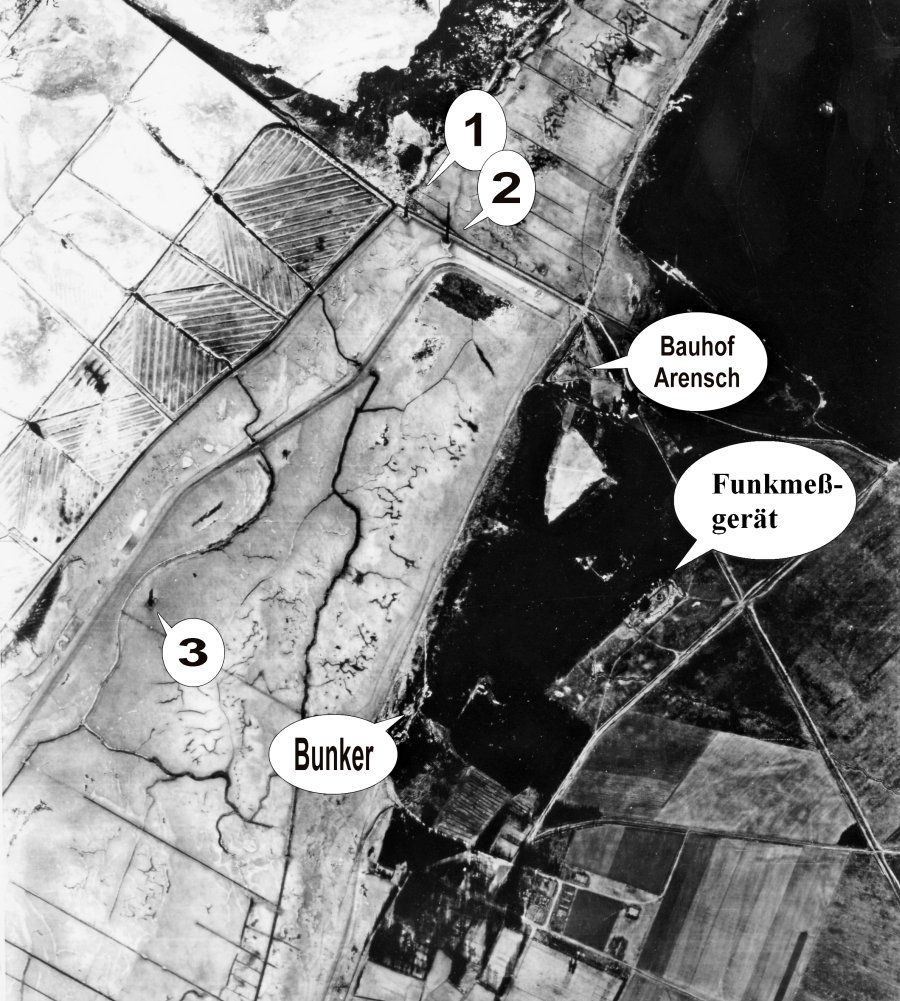
Source: Gerd Wildfang - Aerial photo 12/1944
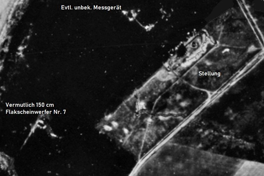
- Small bunker - concrete foundation still present.Probably measuring station "AEGIR" - nothing leftUnknown object - nothing leftPossibly measuring deviceProbably anti-aircraft searchlight No.7
The area was protected against low-flying aircraft by a light 3.7 cm anti-aircraft gun, which was reportedly located at the Altenwalde firing range. It was said to have been located in the immediate vicinity of the construction yard. Another 2 cm gun was located on the Mäuseturm near the former Berensch post-convalescent home.
Source: Gerd Wildfang - Aerial photo 12/1944
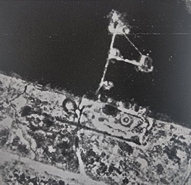
Vergrößerung der Aufnahme im Bereich der Stellung, es ist davon auszugehen das es sich hier ausschließlich um Heidegebiete handelte. Die heutige Bewaldung gab es zu der Zeit dort noch nicht. Auf Grund der groben Auflösung ist es leider schwierig, genaue Detailangaben über Art der Geräte, Bewaffnung oder Strukturen zu machen.
Fotoquelle: Gerd Wildfang
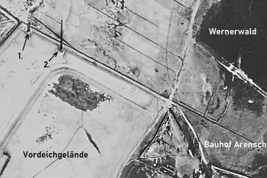
Point 1 was a small bunker, point 2 was probably the "AEGIR" measuring station. Its apparent size is deceptive, the photo was probably taken late in the afternoon. The sun is very low in the southwest, which means that long shadows can be seen. Source: Gerd Wildfang - aerial photo 12/1944
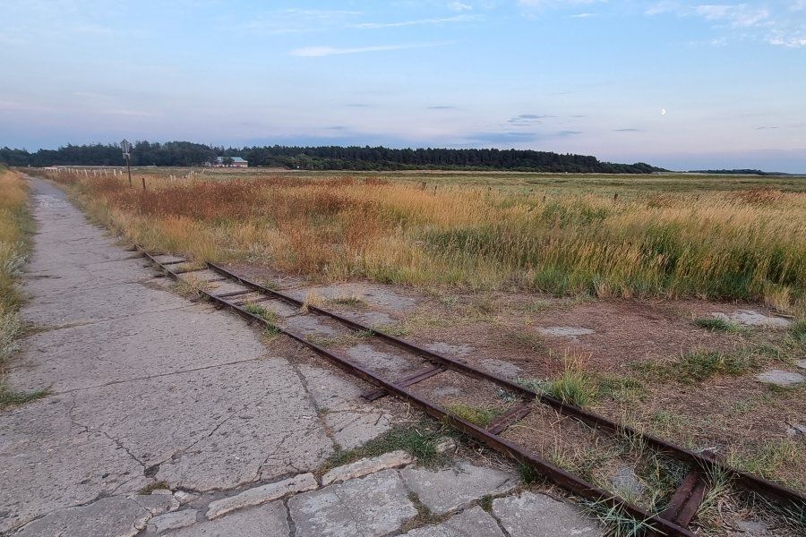
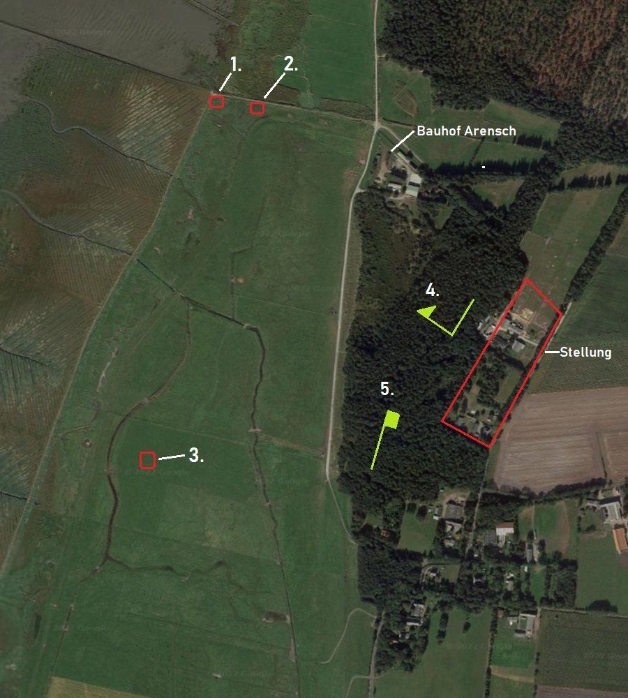
The location of position no. 1, you can still see the overgrown concrete foundation. In the background are the buildings of the Arensch construction yard. Behind it was the radio measuring position, but still without the forest.Photo: M.Brütt 2022
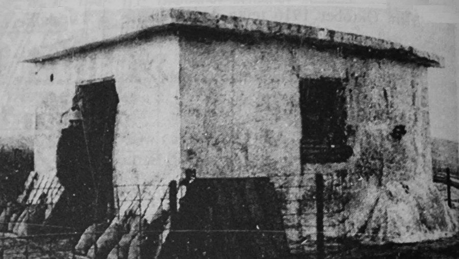
The bunker from position 1. According to a former mudflat hunter, the building was confirmed to be at this location. It was finally demolished in 1983 by an explosion. Photo: City Archives
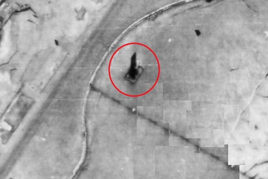
Ein weiteres unbekanntes Objekt im Arenscher Deichvorland. Heutzutage ist davon nichts mehr zu erkennen, nicht einmal Fundamente. Auf dem Foto ist der Schattenwurf ebenfalls groß und verschleiert die wahre Größe des Objektes.
Quelle: Gerd Wildfang - Luftbild 12/1944
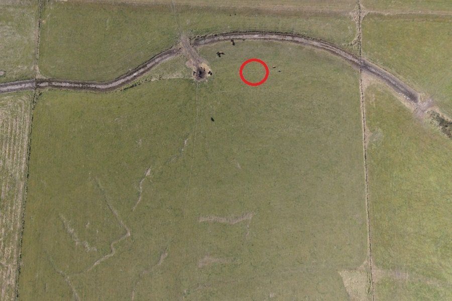
A photo from today. The object to be searched for was in the place of the red circle. The individual points are cattle.Source: M.Brütt 2022
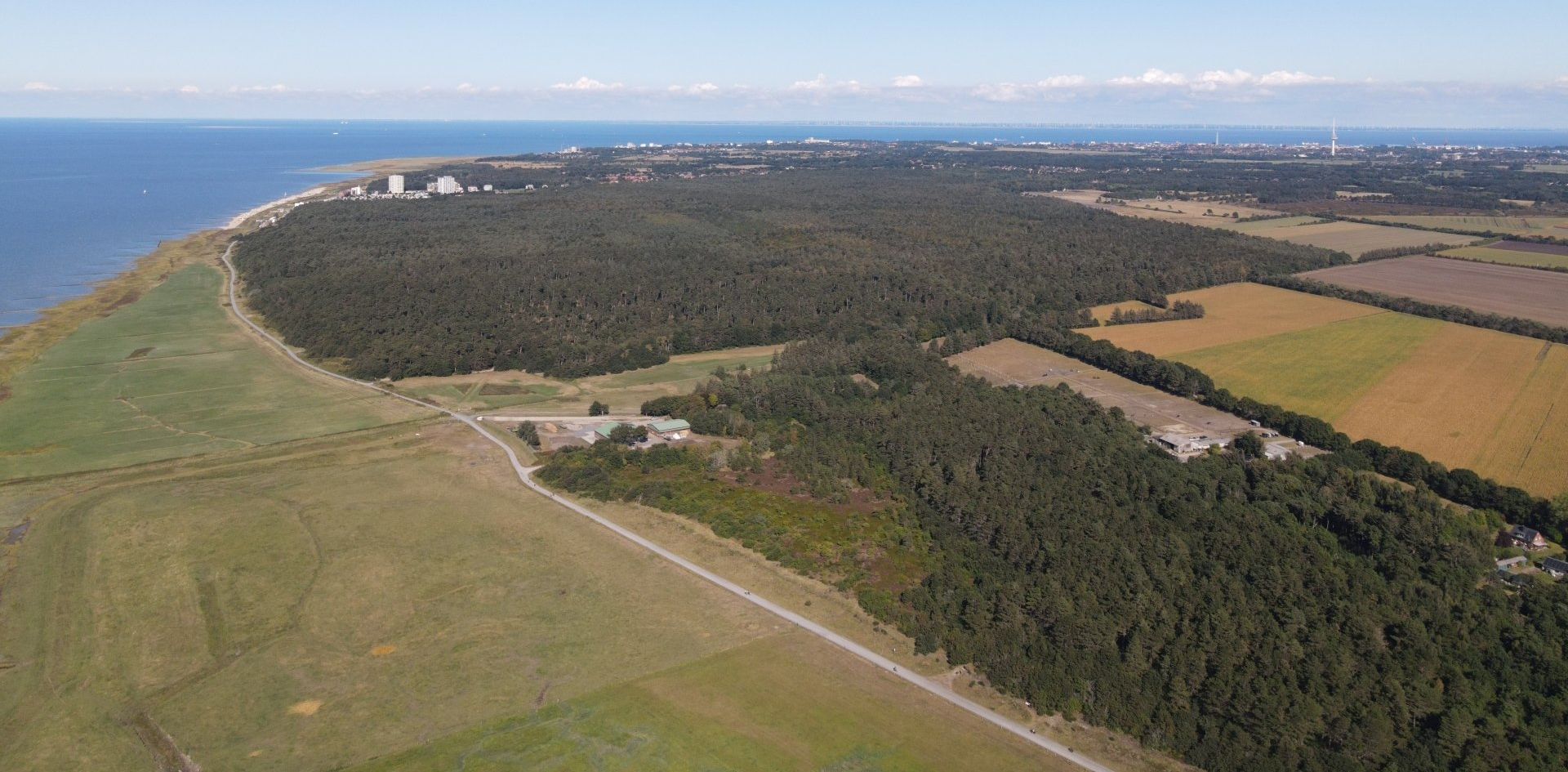
The area of the Arensch measuring point from today's perspective. In the foreground the NLWKN construction yard, behind it the Wernerwald with Sahlenburg. The position was located at the bottom right of the picture and stretched over parts of the current wooded heathland.Source: M.Brütt 2022