


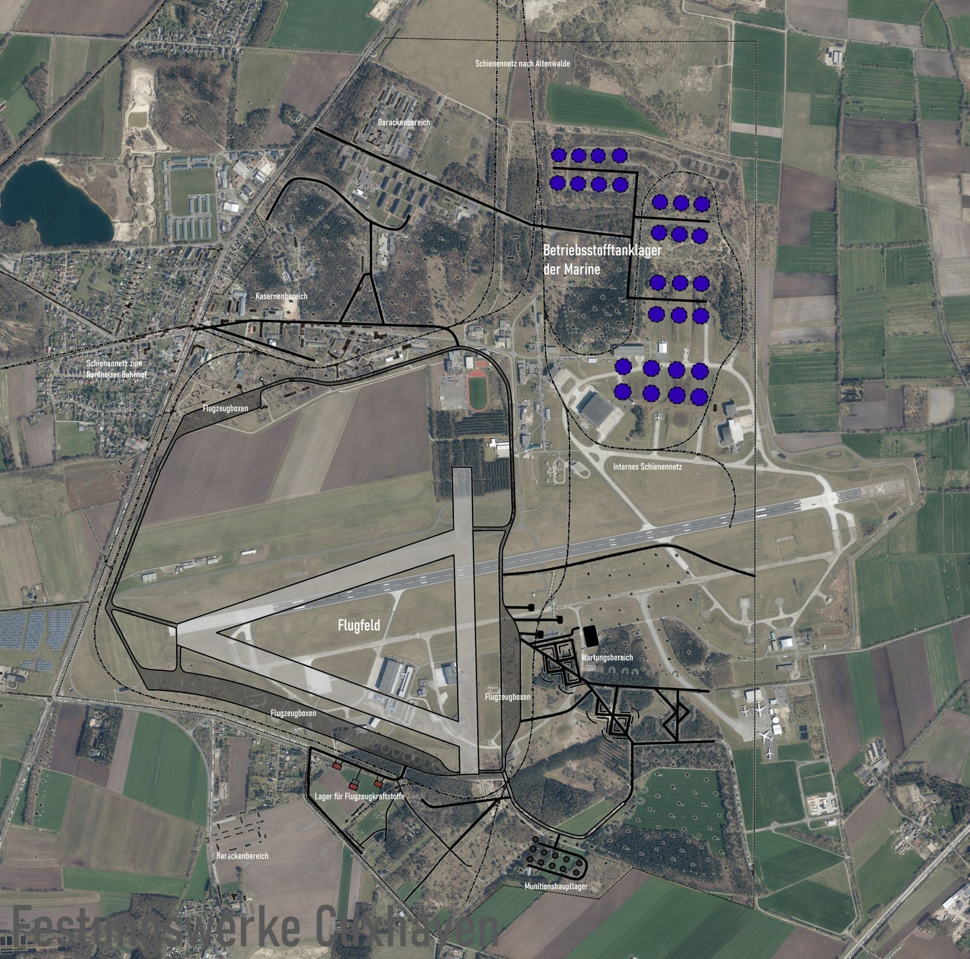
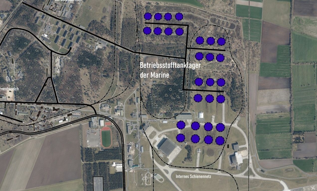
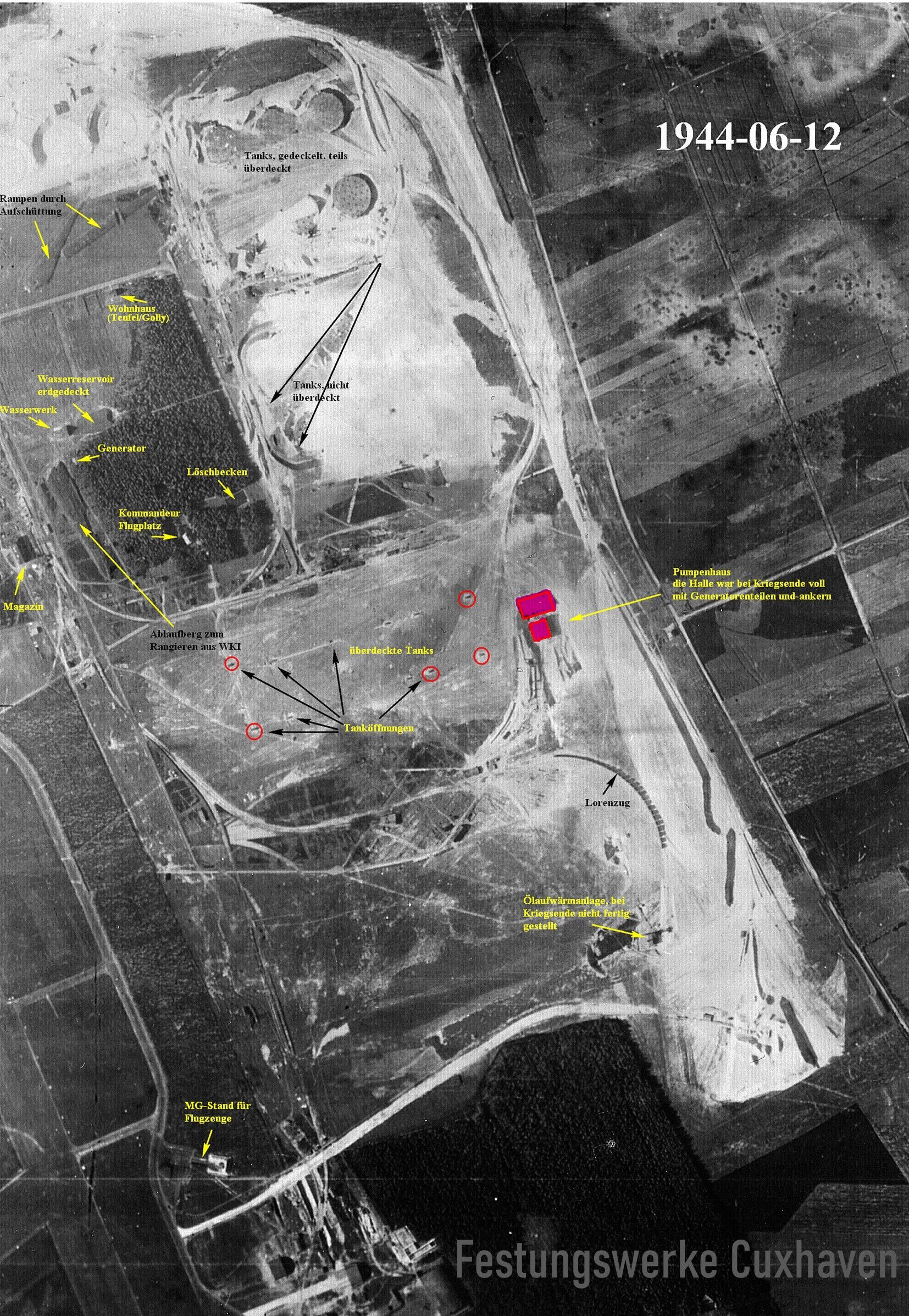
Die Reichsmarine baute 1939 zur Versorgung seiner Einheiten ein unterirdisches Reserve Treibstofflager an der Nordgrenze des Fliegerhorstes. Geplant wurden anfangs 16 Behälter mit einem Fassungsvolumen von je 10.000 m3 und 24 Behälter mit einem Volumen von je 20.000 m3, fertiggestellt wurden bis Kriegsende letztendlich aber nur 24 Tanks.
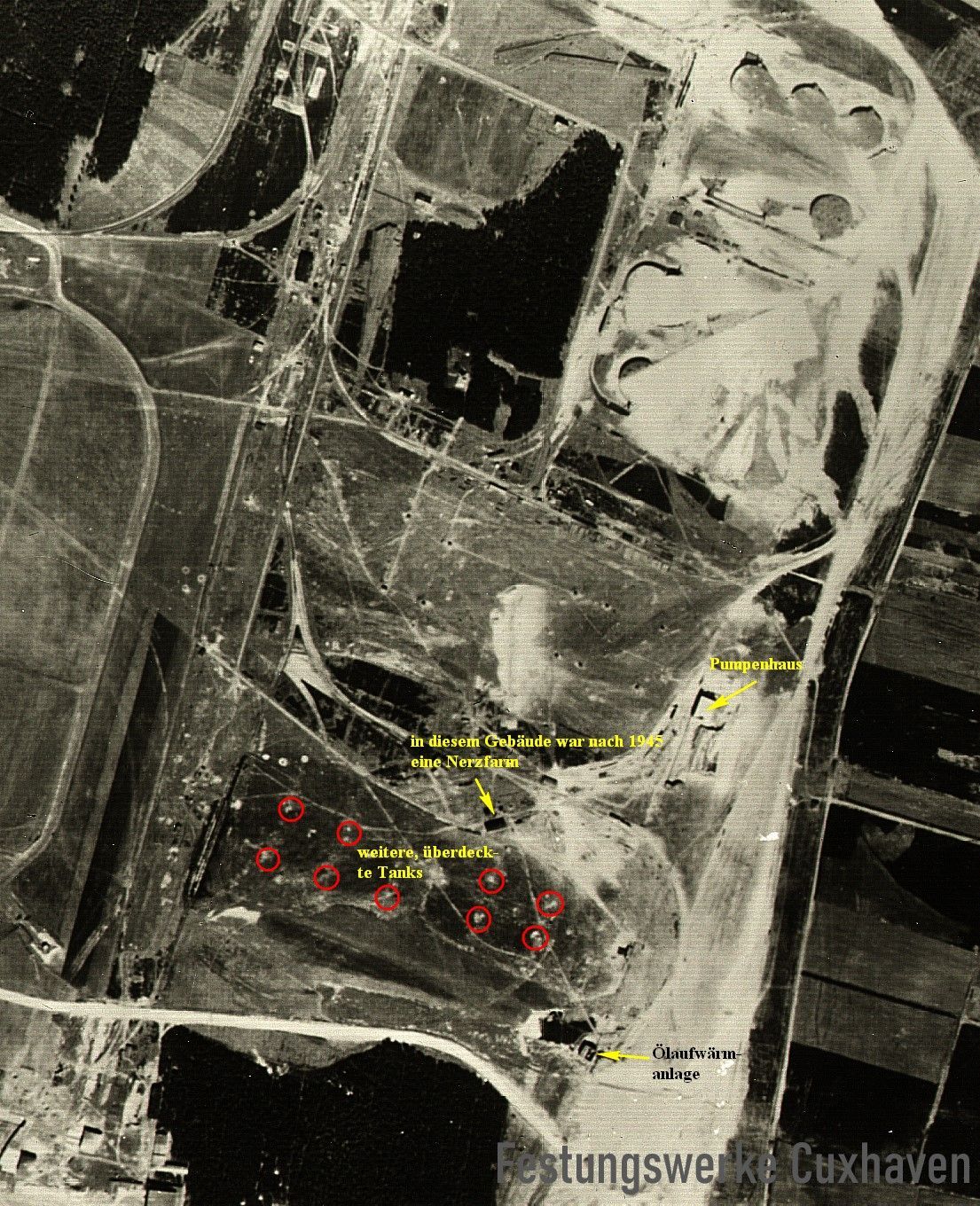
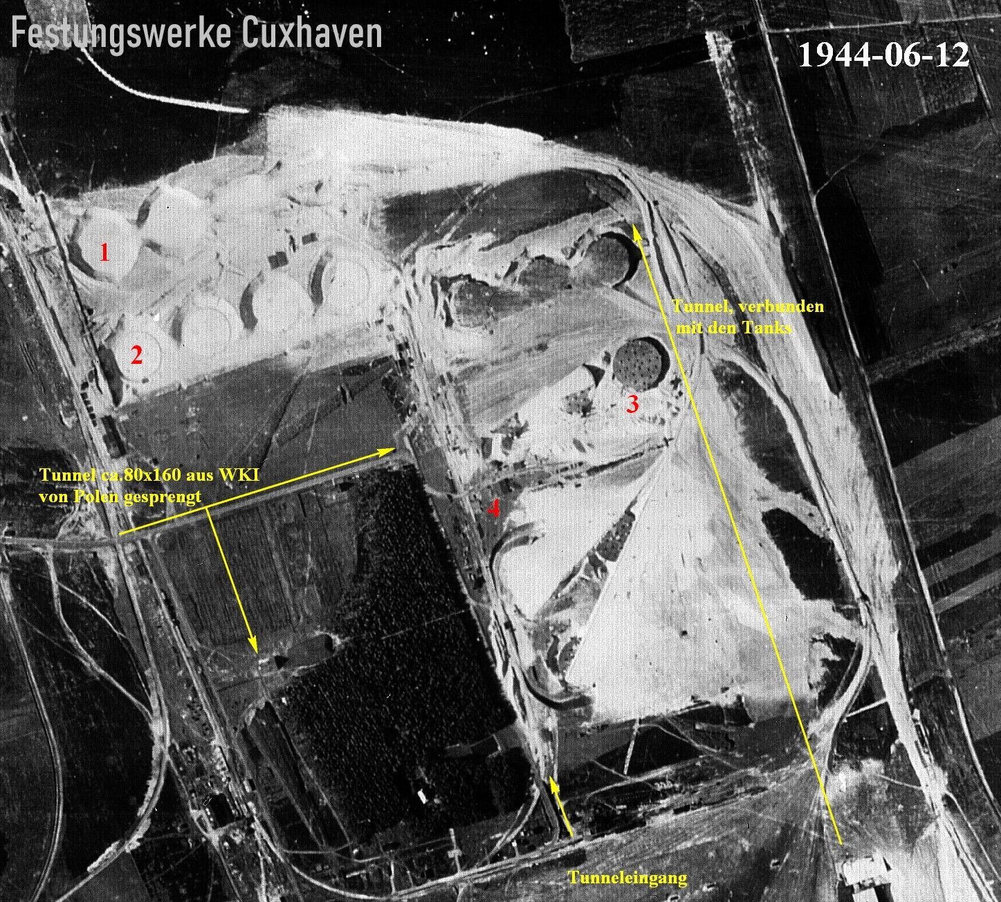
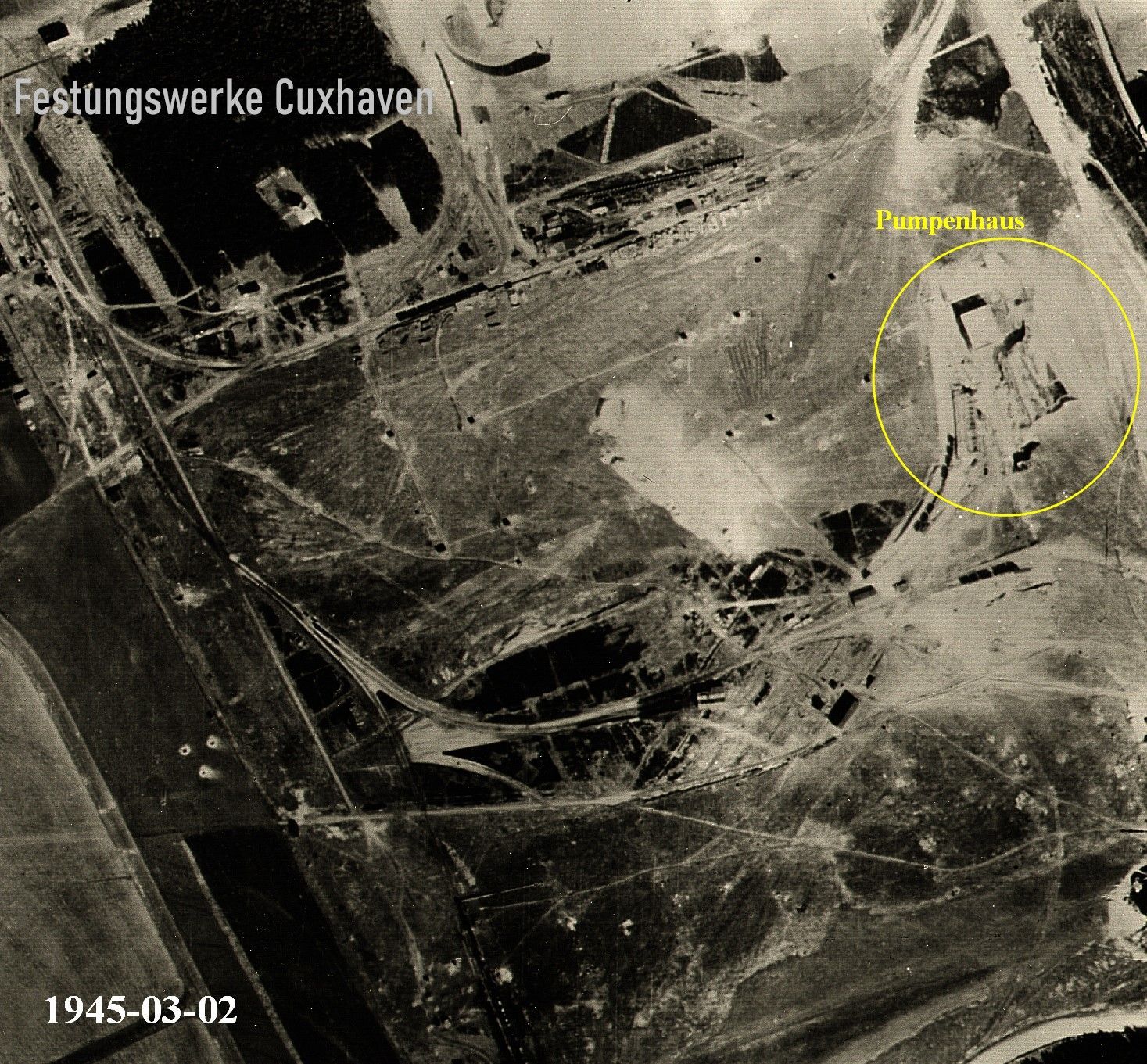
Die beabsichtigte Gesamtkapazität in der letzten Ausbaustufe betrug allerdings 1,5 Mio m³ in 81 Tanks (Bauart: genietete Stahltanks mit Stahlbetonschutz). Die einzelnen Behälter waren durch Leitungen in betonverstärkten Tunneln miteinander verbunden. Ein Drittel der Tanks waren vergraben, der Überstand wurde mit Boden abgedeckt und mit Gras und Büschen getarnt. Von den insgesamt 24 Tanks gingen lt. Recherche der Ligar nur die Tankgruppen 1 und 2 in Betrieb. Sie befanden sich im südlichen Bereich des Mineralöllagers Nordholz und bestanden aus je 12 Einzeltanks mit einer Kapazität von jeweils 20.000 m³. Weitere Tanks waren bei Kriegsende zwar teilweise schon fertig gestellt, sollen jedoch nie genutzt worden sein. Ob weitere zwei Einzeltanks,die zwischen den Tankgruppen 1 und 2 angeordnet waren, ebenfalls nicht genutzt wurden, konnte nicht geklärt werden (Q 326-2). Die Verteilung des Öls erfolgte über drei Pumphäuser aus Stahlbeton, die das Öl mittels Pipelines zu den verschiedenen Tankbatterien pumpten. Die Stromversorgung der erforderlichen Maschinen erfolgte über das öffentliche Netz. Bei Stromausfall konnte auf ein 55 KVA Notstromaggregat zugeschaltet werden, das im Wasserwerk an der Altenwalder Chaussee stand.
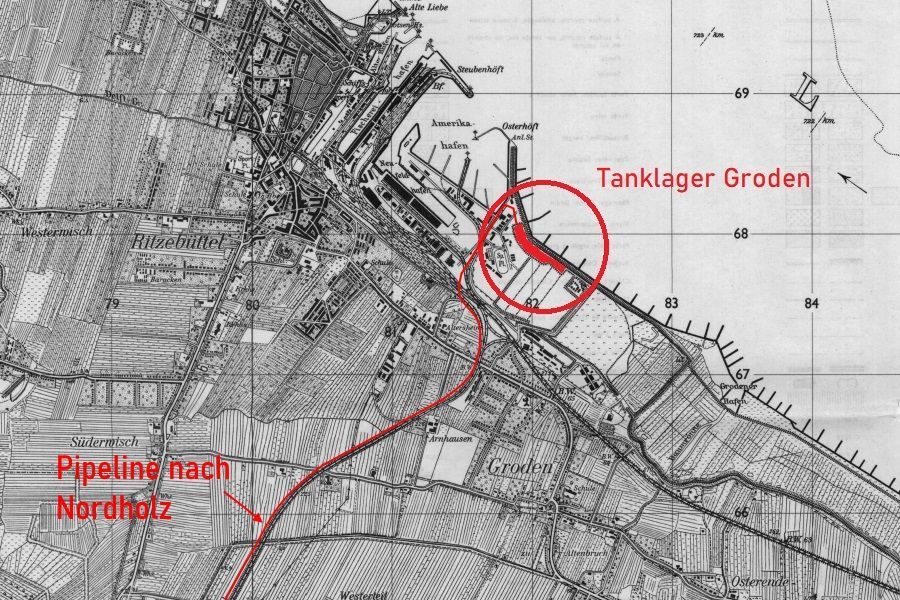
Das Tanklager selbst war über eine 9 Kilometer lange dampfbeheizte Doppelrohrleitung,
die parallel zur Bahnlinie Bremerhaven verlief, direkt mit dem Minensucherhafen (Amerikahafen) in Cuxhaven/Groden-Neufeld verbunden. Im Minensucherhafen direkt an der Elbseite befanden sich vier weitere große und zwei kleine Vorratslagertanks, die in erster Linie als Puffer für Schiffsladungen dienten.
Die jeweils 25 cm und 30 cm dicken Doppelrohre der Pipeline waren in einem bekrichbaren Tunnel untergebracht, der mit Kork ausgekleidet war. Das Pumpwerk im Grodener Marinehafen hatte eine Transportleistung von ca. 250 m3 pro Stunde, weitere Verstärkerpumpen waren in bestimmten Abständen entsprechend in Pumpenschächten verbaut. Zur Sicherung der Pipeline war diese entlang der Strecke mit mehreren Maschinengewehrständen versehen.
Eine weitere kleinere Pipeline führte direkt vom Marinetanklager zum Treibstofflager des Flugplatzes an der Südseite des Areals, welches für die Versorgung der Kampfflugzeuge und Geräte zuständig war.
Weshalb die Marine ein Tanklager so weit vom Meer entfernt baute, bleibt bislang ungeklärt. Vermutlich liegt der Grund hier, dass man hoffte der Gegner würde dies nicht so vermuten. Allerdings war den Alliierten bekannt wo sich das Lager in etwa befand. Ebenfalls der Verlauf der Pipeline, die einige Male von Tieffliegern erfolglos angegriffen wurde.
Laut Aussagen von Zeitzeugen des ehemaligen 86th FG. der 12./ USAAF, sollen allerdings nicht alle Behälter als Tanks genutzt worden sein. Einige davon waren auch duch Tore ergänzt und als unterirdischer Lagerraum genutzt worden.
Quellen:
https://bunkerkiel.4lima.de/nordholz,
Gerd Wildfang (Militärische Bauten der Festung Cuxhaven),
AFHRA A5257A S.619 (1944/45),
div. Kriegstagebücher,M.B.
The naval fuel depot was located on the north side of the Nordholz Air Base.
There are still remains of some tanks underground.
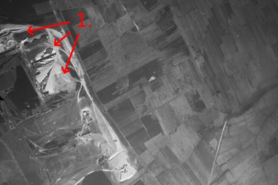
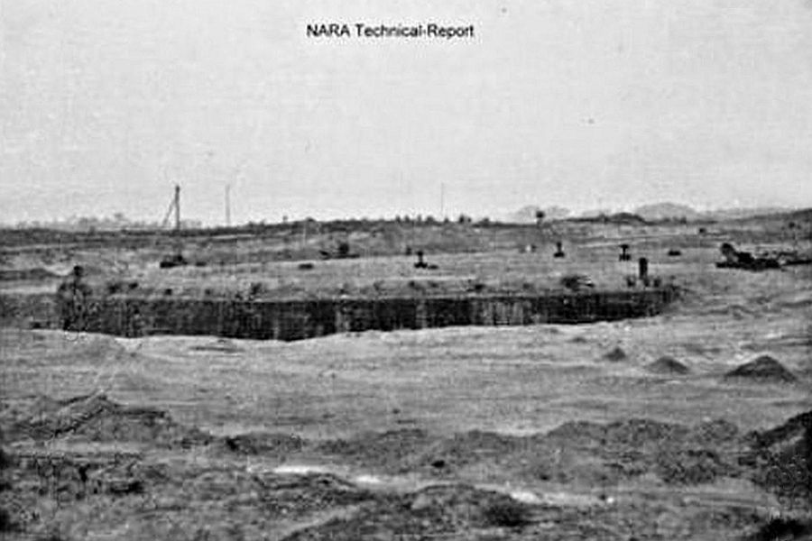
The construction of the tank farm apparently lasted from 1939 until the end of the war and was ultimately never finished. This photo 1 from October 1944 shows further work on the northern side. The southern tanks can only be guessed at. But from the air, the light spots in the sandy heathland soil caused by the ongoing work are clearly visible. The sand required for the entire construction of the tank farm was taken from the "Hohe Lieth" sand pit. Photo: RAF
- Extension of the tank farmThe northern accommodation camp for the crewsRailway line of the Nordholz Marine Railway
Photo: RAF
Source: Gerd Wildfang
Source: Gerd Wildfang
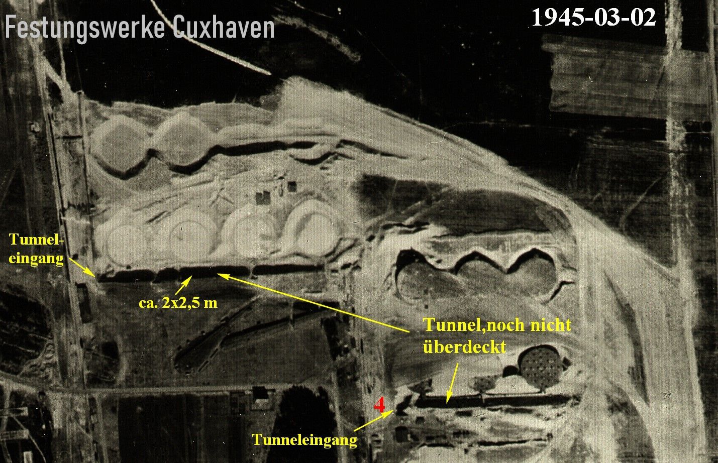
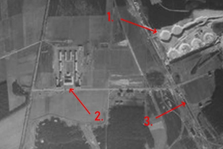
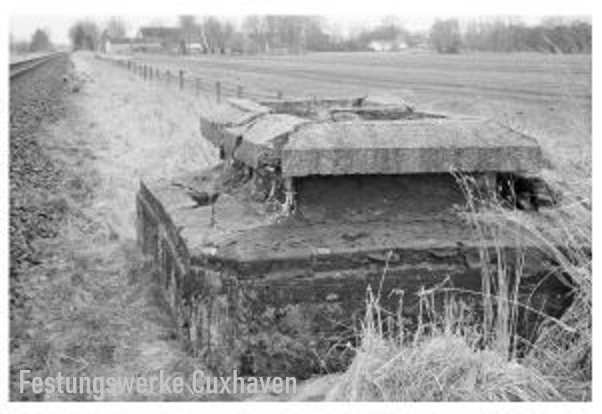
There were corresponding pipeline tunnels between the individual tanks. The tanks at the north-east corner had not been covered with sand until the end of the war. At the end of the war, the tunnel (at No. 4) served the population as protection against attacks/bombs. The company that carried out the demolition work after 1945 had its explosives depot near the entrance. Heinrich Wehrmann was a demolition expert at the time. Source: Gerd Wildfang, photo 4005
- Ausgehobene Grube für runden Öltank, nach 1945 fand hier Pulververbrennung statt.
- Entweder besteht schon die Bodenplatte oder ein Teil der aufgehenden Wand, da sich der Kreis abzeichnet.
- Fertiger aber noch nicht zugeschütteter Tank.
- In diesem Bereich befand sich ein Verbindungstunnel zwischen den Tanks bis zur Ostseite, an der entlang ein weiterer Tunnel verlief.
Source: Gerd Wildfang
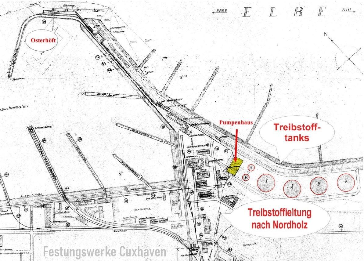
The pump house, dimensions approx.: 30 x 30 m and 11 x 15 m; yellow =? ramp/barracksSource: Gerd Wildfang
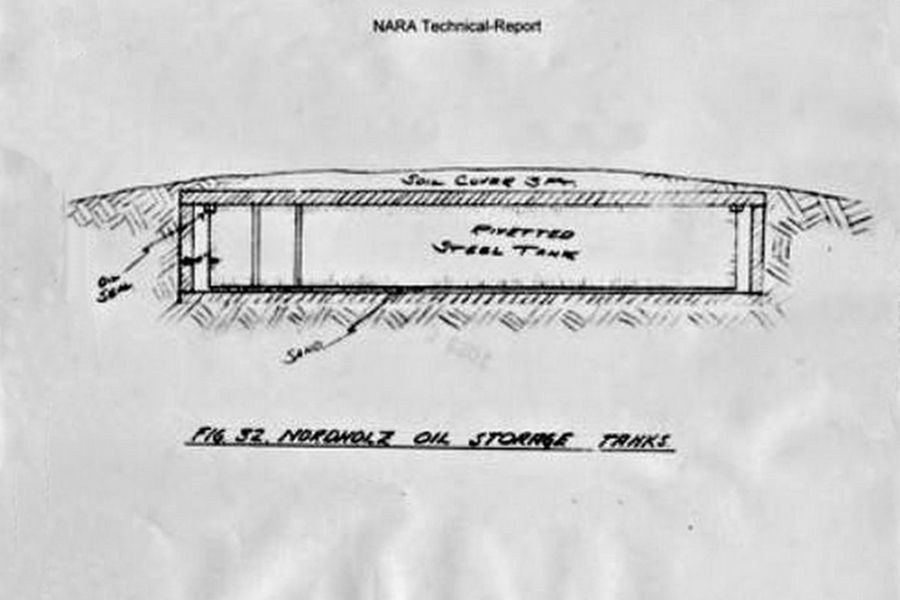
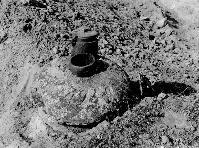
Cross-section of an underground tank of the marine fuel storage facilitySource: Gerd Wildfang
A finished underground tank that is not yet covered with excavation material.Source: Gerd Wildfang
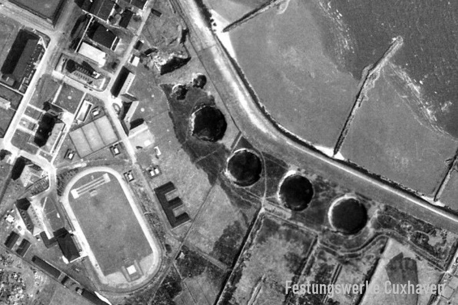
Tanklager Minensucherhafen Cuxhaven (Amerikahafen)
The oil tank farm in the minesweeper harbor consisted of a pump house and a total of 6 underground oil tanks. Two of these former oil tanks had a diameter of 20 m, and 4 oil tanks had a diameter of 50 m. In the "List of war-important Wehrmacht buildings (navy) in the area of the Defense Economic Inspectorate X. Hamburg, as of October 1, 1939: are listed under section A - shipyard, harbor and power buildings, current number of the OKM number: 5109 BBB Cuxhaven: 105 A 1469 4 oil containers each 10,000 m³, start/completion 10.1939 with costs of 3,000,000 RM and under A 1481 bridge for taking on oil for large ships 1939 - October 1, 1940. (However, the aerial photographs show that construction activities continued until the beginning of 1942, and construction was stopped in 1943. Q326-1)The fuel supply was via a dock in the minesweeper port and a railway line. A pipeline led from the pump house to the "Osterhöft" in the northwest, one to the "Queen Louise Bridge" in the minesweeper port and another to the Nordholz airfield.Source: Gerd Wildfang
The tank farm with the storage tanks was located at the eastern end of the minesweeper port in Groden-Neufeld. The pipeline to Nordholz was located along the railway line to Bremerhaven to the south.
1943, Minensucherhafen [Amerikahafen] in Cuxhaven: Treibstofftanks und Treibstoffleitung nach Wursterheide/Nordholz:
Quelle Gerd Wildfang
Ein Foto von 1958, mitte unten liegt der "Neue Fischereihafen". Dahinter die Gebäude des ehemaligen Minensucherhafens (Amerikahafen). An der Deichgrenze, die Krater der gesprengten Öltanks.
Quelle: Gerd Wildfang
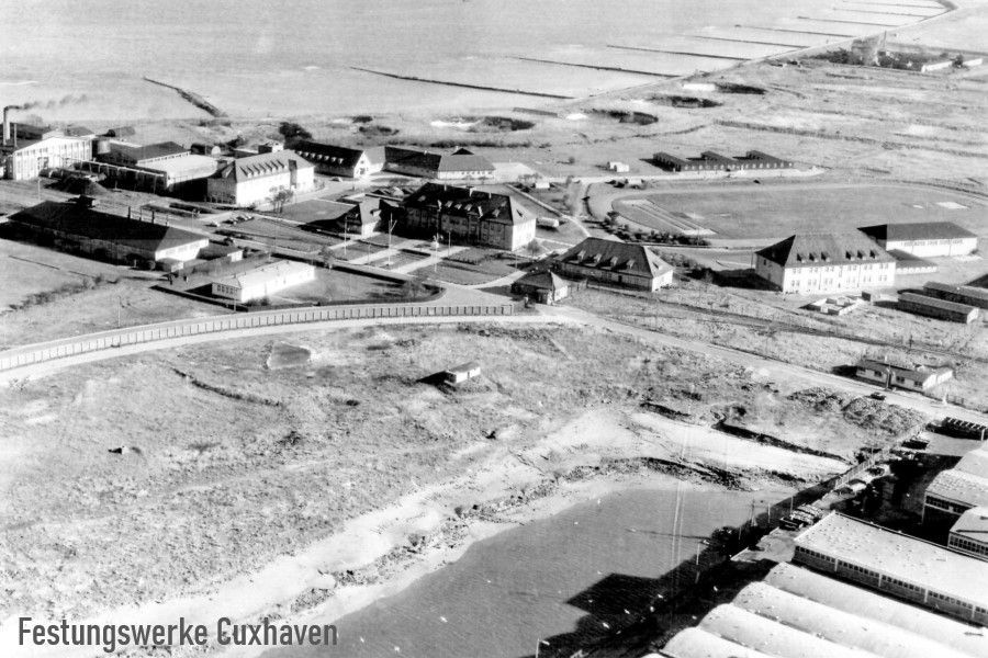
An aerial photograph with a top view of the siteSource Gerd Wildfang
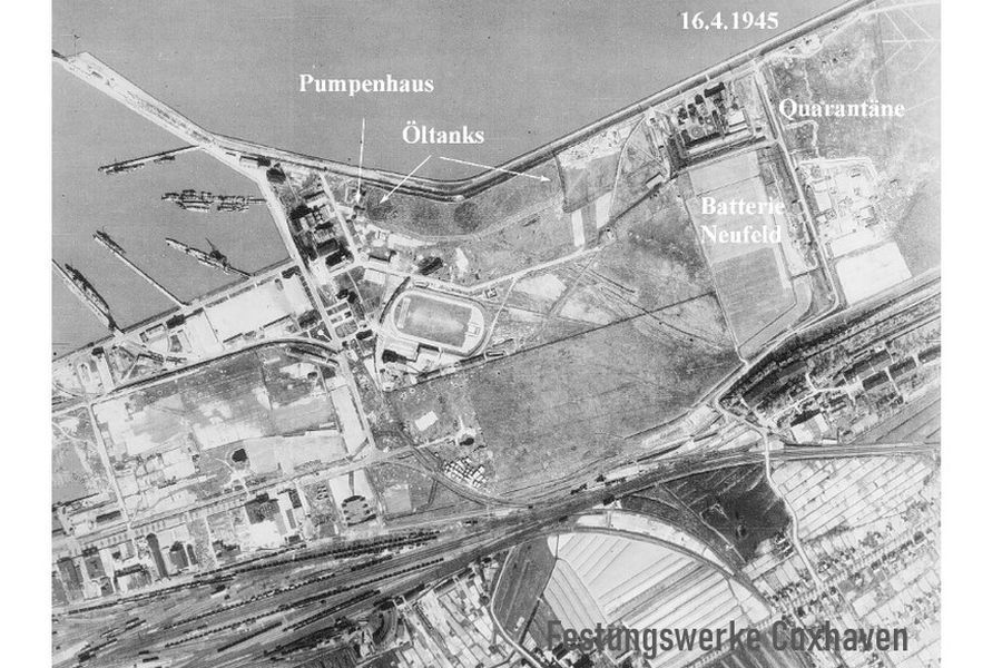
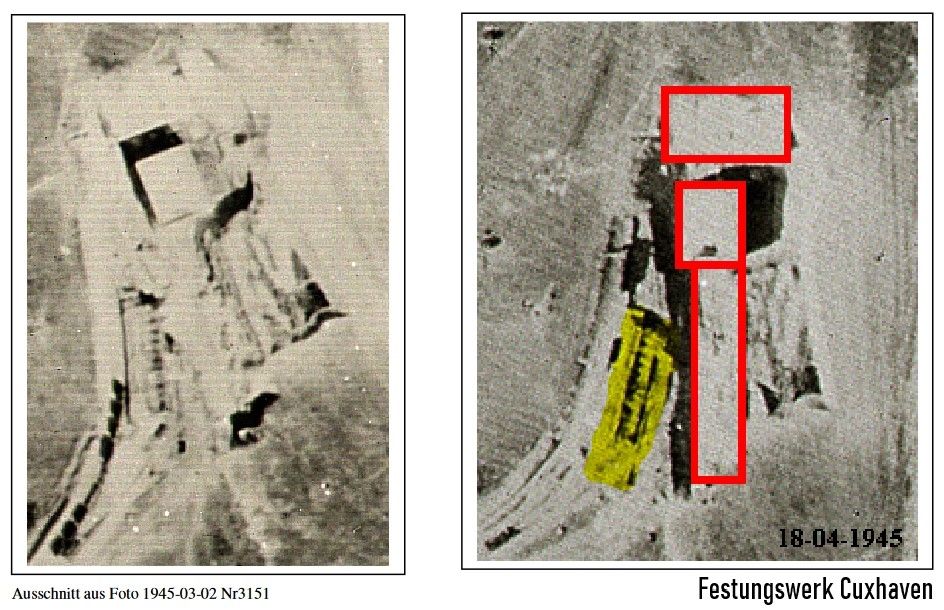
Aerial photo from 16.04.1945, the tanks are only vaguely visible due to their underground camouflageSource: Gerd Wildfang
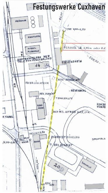
The Pipeline (long-distance canal) Minesweeper Port - Cuxhaven<-----> Naval fuel depot (air base) Nordholz
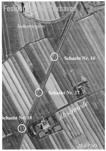
The Nordholz tank farm was connected via a double-pipe pipeline, approximately 9 km long, which ran along the western side of the Cuxhaven-Bremerhaven railway line and from Franzenburg along the new "Marinebahn" route. The two pipes of this double line had a diameter of 25 cm and 30 cm and were laid in a concrete channel. The powerful pumping station in the port was able to push a ship's load of 10,000 tons through the pipes in three hours. The route was secured by several machine gun stands. In addition, communication cables and electrical cables were carried in the piped system. The increase in the viscosity of the operating materials within the pipeline - a decrease in flowability - that occurs at low temperatures was attempted to be prevented by heating the oil with steam. The pipes were located in a crawlable corridor that was insulated with cork panels. In numerous reports by young people who went out after the war to discover and steal non-ferrous metals, there was always a corridor in which the pipes were laid, which could be walked through while bending. The pipes were sometimes laid up to 6 m below ground level or were covered by a dam - as was the case south of the Marinebahn in front of Köstersweg. In view of the sections of the pipes that are now available, it seems appropriate to doubt these statements, but at an average height of 80 cm to 130 cm, the channels would still have been crawlable for young people. Source: Gerd Wildfang
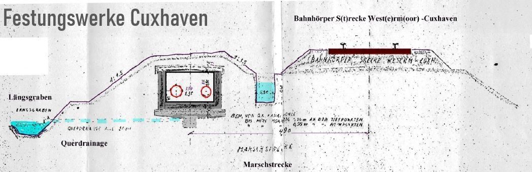
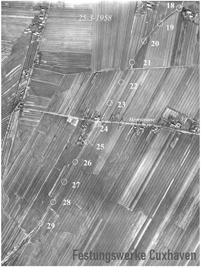
Example: Route of the long-distance canal along the track of the Westermoor_Cuxhaven line.Source: Gerd Wildfang
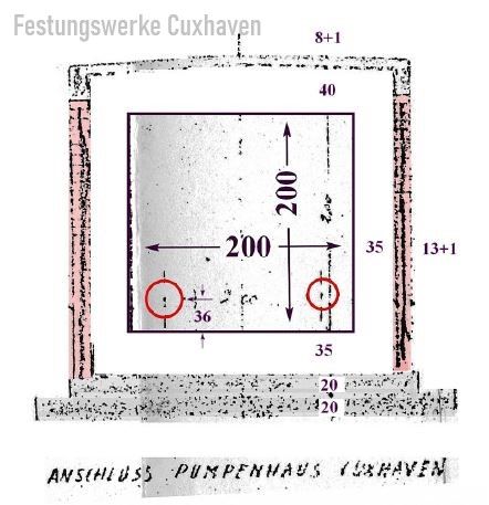
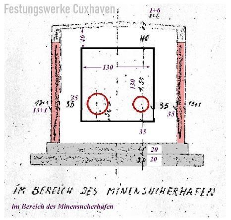
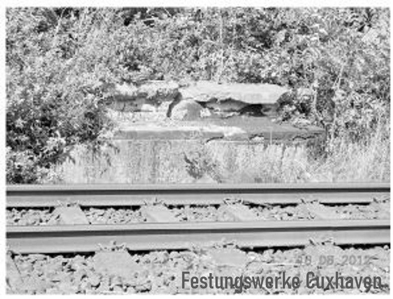
The standard inner width of the canal was 130 cm, the heights varied between 80 cm and 130 cm, at the pump house in the minesweeper port it was 200 cm, the covering was between 35 cm and 500 cm. In some cases, the canals were given a half-stone protective wall. The cover with a 15 cm hood and insulation is shown, but not clearly, as the inner space is drawn as rectangular/square. All cross-sections have the same position of the pipes with a 36 cm side and height distance from the bottom of the canal to their respective pipe axis. The pipe diameters are not recorded. It is assumed that the pipes were laid in the canals that were open at the top and then closed with a cover. Source: Gerd Wildfang
Zerstörung der Öltanks im Minensucherhafen, der Ölleitung und der Tankanlagen in Nordholz
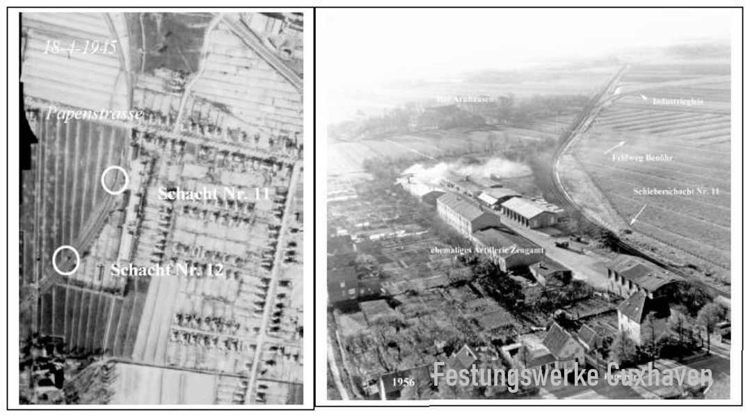
After the Americans had initially used the fuel line with the airfield for a while, it was also blown up. The work began at the airfield with daily stages of around 600 to 900 m. No report could be found on the dismantling = uncovering and opening the channel and recovering the pipes. Only a brief report was made on the blasting of the access shafts and their collapse (209). It is said that mainly Polish units were involved in the blasting.
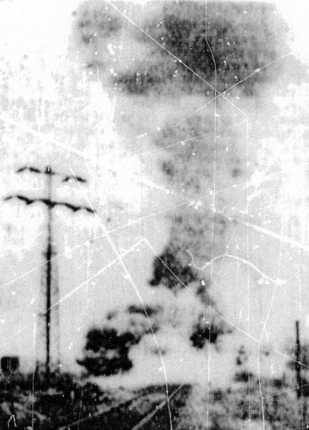
1948, Sprengung eines Pumpenschachtes entlang der Bahnstrecke
Quelle: Gerd Wildfang
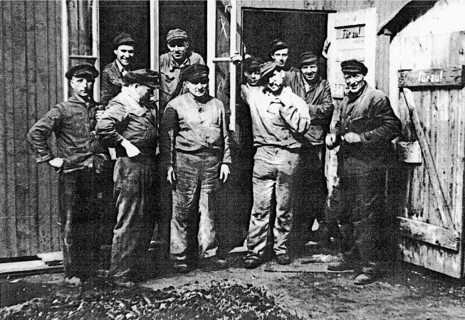
Construction crew from Voss in front of a barrack /Photo Q 233Source: Gerd Wildfang
The pumping systems in the minesweeper harbor, which pumped the fuel between the tanks at the harbor and to Nordholz, were dismantled in Cuxhaven after 1948. Dismantled into numbered individual parts and packed in boxes, the pumps were sent to Poland together with construction drawings as compensation. Under the supervision of an English officer, this work was carried out by a construction crew from the Voss company, which later transferred to Hoppe & Krooß. In the 1996 calendar "Workers" published by Wilhelm Heidsiek Verlag (Q 233), the construction crew is pictured standing in front of their hut. As late as 1966/67, the destroyed canal/tunnel in the area of the large sand pit in the city of Cuxhaven, which adjoins the Köstersweg, could still be accessed, as the end of the canal was suddenly exposed due to sand mining. The canal and the pipeline were removed. The ends of the tunnel were then closed. The sand pit was used commercially by the city. According to various research into military waste undertaken in the 1990s, no clarity could be obtained about the removal of the pipelines (Q 326, 327)
A short section of the blown-up passage was still visible later on at the edge of Nordholz airport and led to inquiries and complaints from Polish observers during the first inspection visits as part of the CSCE, who were denied access to the blown-up passage. It was suspected that the German military was keeping secrets. The complaints from the observers were eventually resolved. The oil tank facilities in the minesweeper port were blown up shortly after the war. By 1958, 6 oil tanks and the pump house had been removed. The 4 large oil tanks were only removed down to the base plates in the 1960s as part of dike extension measures. In 1992, the Otto Plambeck company was commissioned to carry out the dismantling work. After the demolition of the pump house and the repair of the oil damage in its surroundings in the following year, only 2 oil tanks (20 m diameter) were to be dismantled, with the walls being demolished as far as necessary and the tanks then filled. Source: Gerd Wildfang
Sources:
(263): Heinz-Günther Reinhardt, Chronicle of the municipality of Nordholz, Part 1 and Part 2, 2012; additions (Rolf Matthes, Friedrich Paul, UweSchicke) are inserted in italics(242) Hein Carstens, Ships in the sky - the former airship port of Nordholz through the ages; published by the men from Morgenstern, Bremerhaven 1989, , from p. 105).(298) Luftwaffe Airfields 1935-45 Germany (1937 Borders), by Henry L. deZeng IV, Edition: June 2014(303-a) 100 years of the Bremerhaven-Cuxhaven railway with a branch to Bederkesa; Hans Wolfgang Harden and Wolfgang Rawiel vonRönn, Landesstube Alten Landes Wursten-Museumsbahn Bremerhaven-Bederkesa eV (303b) Hans Wolfgang Harden: Searching for traces - connection and supply of the Nordholz airfield by rail; probably in the newsletter of the Museumsbahn Bederkesa (309) Holger Piening a) North Sea coast in the war 1939-42 - places-events-stories, Boyens 2010; b) North Sea coast in the "total war" 1943-45 - dates, names, backgrounds, Verlag Boyens 2015 (317) Jürgen Zapf, Luftwaffe airfields 1934-1945 - and what was left of it, Volume 7 - Lower Saxony and Bremen; Zweibrücken 2011, ISBN 978-3-86619-064-1