


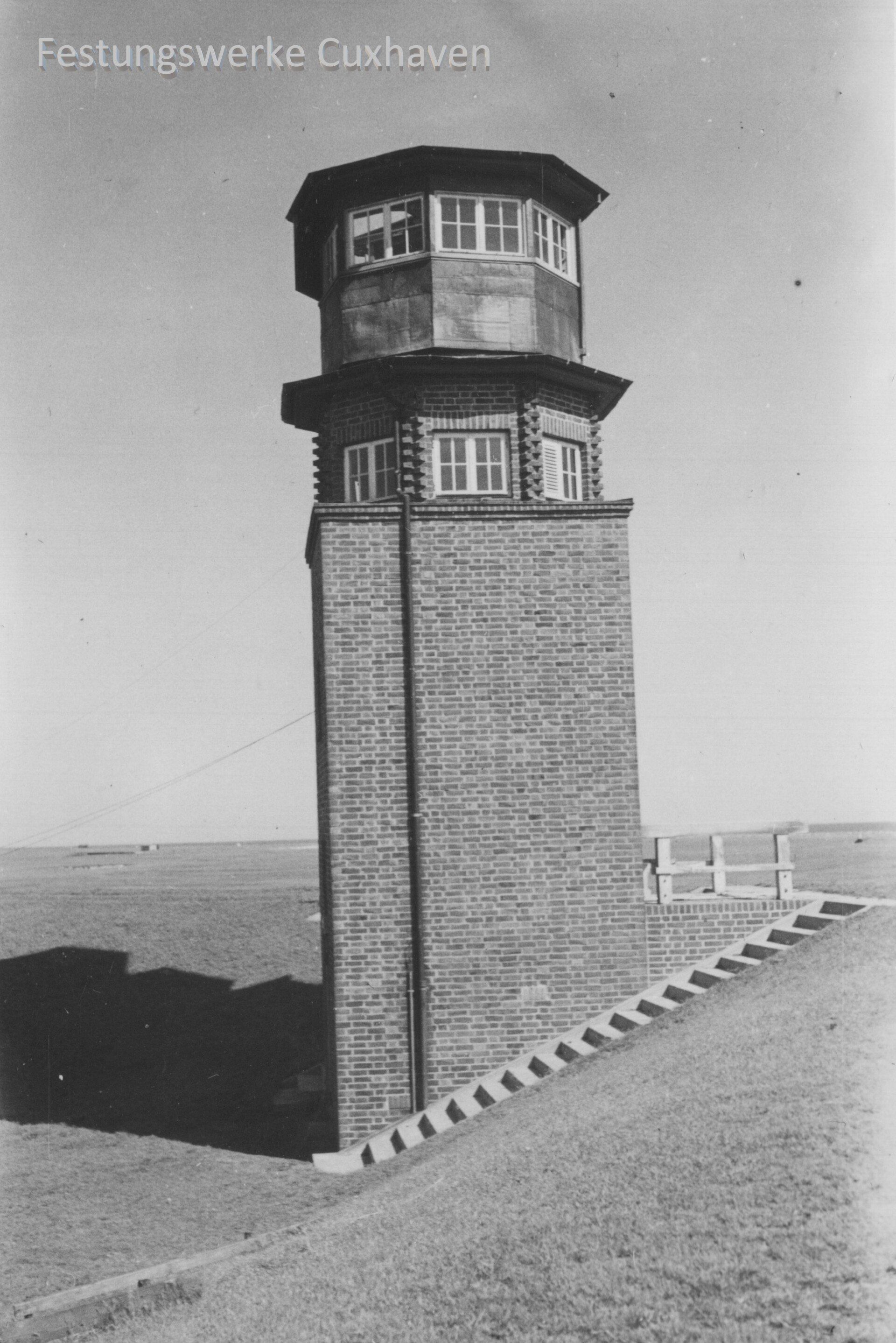
In order to visually evaluate the shells that hit the Wadden Sea off Cuxhaven from the Altenwalde firing range, observation posts were built on the coast of Sahlenburg and on the island of Neuwerk during the First World War. The four measuring posts with the names Aegir, Berta, Caesar and Dora were probably built on the western edge of the Wernerwald in 1917. Open wooden towers had already been set up on Neuwerk before the First World War to determine the points of impact. In the mid-1920s, these wooden frames were replaced by solid measuring posts made of Hamburg clinker bricks. During the firing tests between 1937 and 1945, these towers remained in active operation on the Wernerwald and on Neuwerk. They were also used for optical airspace surveillance.
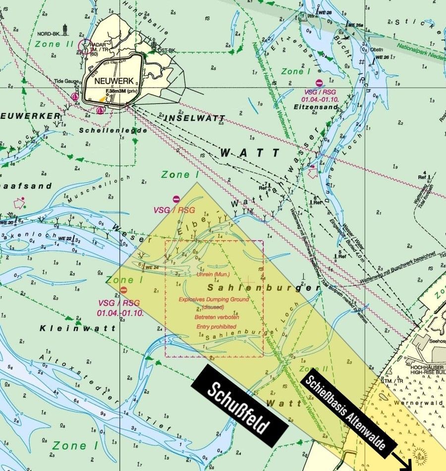
Today, just a few kilometers in the mudflats off Sahlenburg, the ammunition restricted area is still marked by warning signs. Many test shots were fired from the Altenwalde firing base at medium distances in this area and recorded using the observation towers. Until the 1990s, employees of the bomb disposal service were busy during low tide phases recovering washed-out ammunition remnants or rendering them harmless by blasting them on site. Even today, explosive devices uncovered by nature are still being discovered at irregular intervals and have to be rendered harmless by the bomb disposal team from Hamburg or Lower Saxony. However, this has occasionally happened in other areas of the Cuxhaven mudflats due to cross-shots or shelling of other properties.
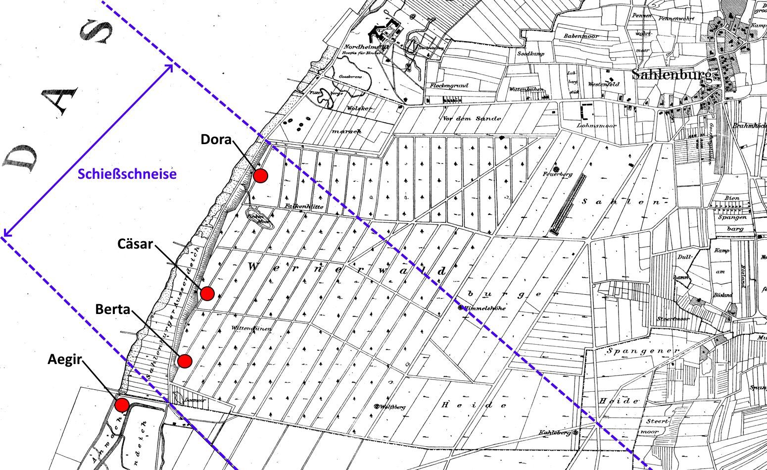
Picture left:
Locations of the former observation posts on the western edge of the Wernerwald towards the sea.
Picture right:
The mudflats between Cuxhaven and the island of Neuwerk. You can see the munitions restricted area off the coast, which was bombarded with various types of munitions from Altenwalde.
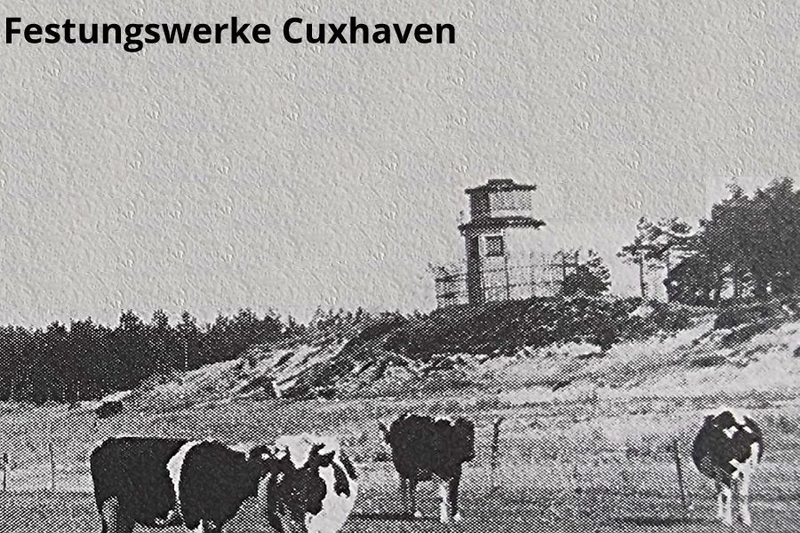
Observation point BertaSource: Gerd Wildfang
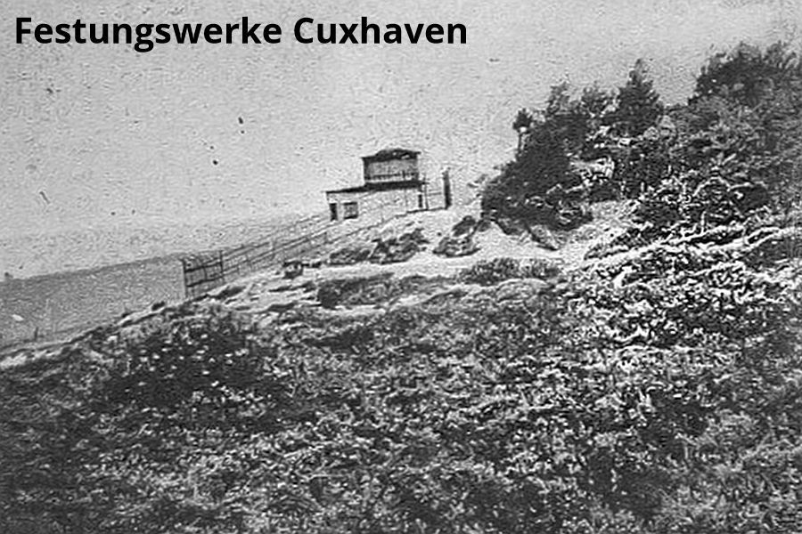
Caesar observation postSource: Hendrik Friedrichs
What: MB
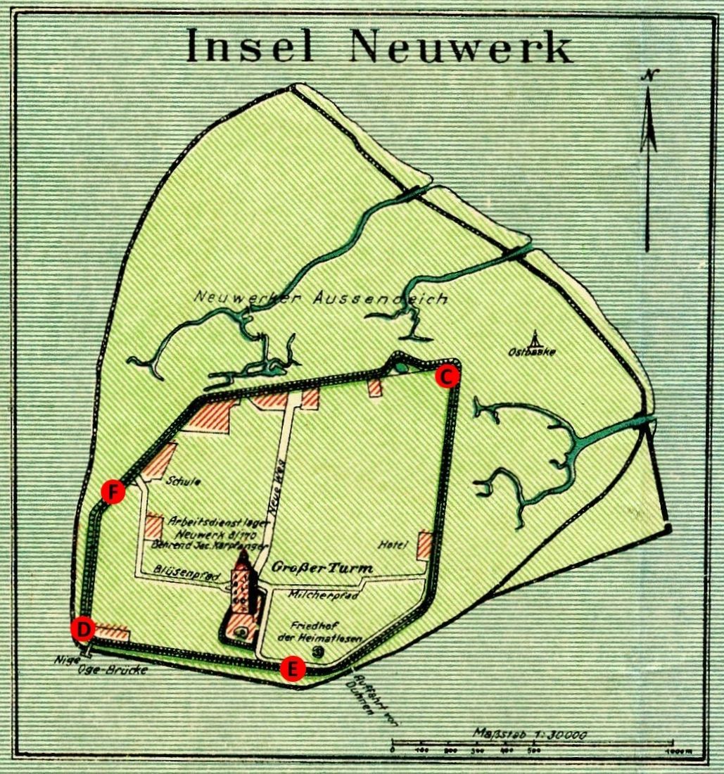
Picture left:
The measuring stations on Neuwerk were built into the dyke at the time. For safety reasons, the last of them were demolished as part of the dyke raising after the severe storm surge between 1976 and 1977.
Picture right:
The measuring station F on the inner edge of the dike slope.
What: MB
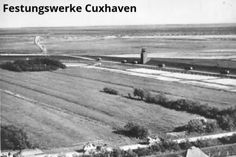
Measuring stand D, the photo probably from the early sixties.Source: MB
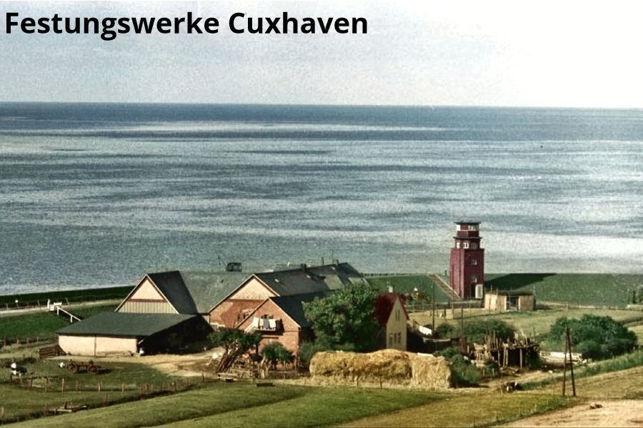
Measuring station E at the Wattwagen ramp Neuwerk.Source: Hendrik Friedrichs
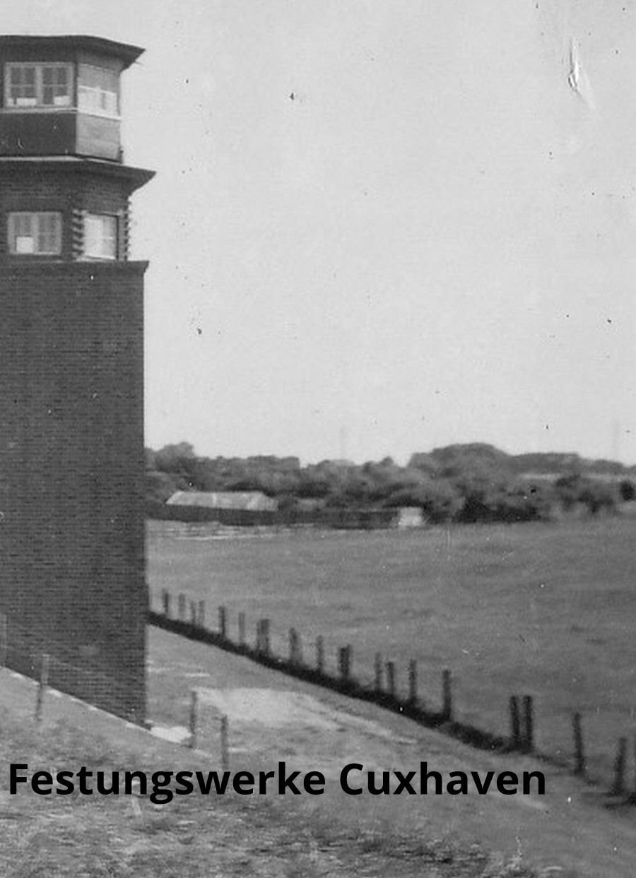
Measuring station C, at the northern corner of the dike of the island of Neuwerk.Source: MB
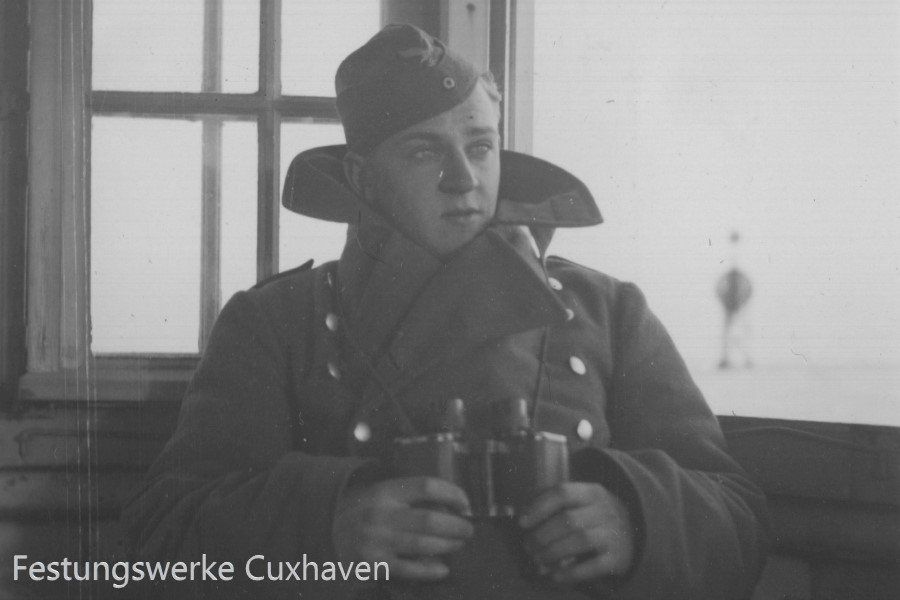
This picture was most likely taken from exactly this measuring station C. The windows and the distance to the east beacon from this position match this. It was also used to observe the airspace by the flight reporting department. Source: MB